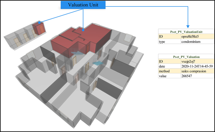
Abstract
Real estate values are needed and used in many finance, engineering, and construction operations. It is significant to assess property values in a standard-based, objective manner. Utilizing Geographic Information Systems (GIS) and Building Information Modelling (BIM) technologies, real estate values can be assessed with three-dimensional (3D) geospatial and built environment analysis. In this study, criteria that affect real estate value are grouped as environmental, physical, legal, and socio-economic factors. Then, the Industry Foundation Classes (IFC)-based 3D property valuation model is designed. By proposing new property sets and properties, features and their attributes are mapped with entities and data types in the IFC schema to demonstrate the likely use of IFC data for property valuation. Conducting BIM{&}GIS analysis for both external and internal criteria, property values can be assessed by using the created holistic model. It is thus aimed to develop a valuation framework that can be used as a reference in several value-based applications such as property taxation, urban renewal, and land share calculation.