Muhammed Oğuzhan METE
Muhammed Oğuzhan METE
Home
Publications
Projects
Posts
Contact
CV
Nominal Land Value Map
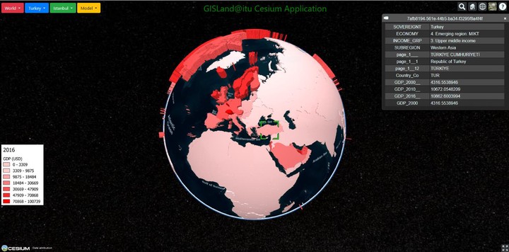
Development of 3D Web GIS Application With Open Source Library
Muhammed Oguzhan METE
,
Dogus GULER
,
Tahsin YOMRALIOGLU
January 2018
PDF
Cite
DOI
Type
Journal article
Publication
Selcuk University Journal of Engineering, Science and Technology
geographic information systems
GIS
3D GIS
Web GIS
open source
Related
Development of 3D Web GIS Application With Open Source Library
Open Source Cloud GIS Framework for Real Estate Valuation
Creation of Nominal Asset Value-Based Maps using GIS: A Case Study of Istanbul Beyoglu and Gaziosmanpasa Districts
Cite
×