Muhammed Oğuzhan METE
Muhammed Oğuzhan METE
Home
Publications
Projects
Posts
Contact
CV
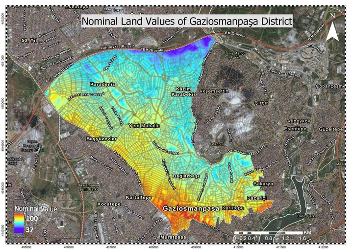
Nominal Land Value Map
Creation of Nominal Asset Value-Based Maps using GIS: A Case Study of Istanbul Beyoglu and Gaziosmanpasa Districts
Muhammed Oguzhan Mete
,
Tahsin Yomralioglu
January 2019
PDF
Cite
DOI
Type
Journal article
Publication
GI_Forum 2019
geographic information systems
GIS
real estate valuation
nominal valuation
Related
Open Source Cloud GIS Framework for Real Estate Valuation
Cite
×