Muhammed Oğuzhan METE
Muhammed Oğuzhan METE
Home
Publications
Projects
Posts
Contact
CV
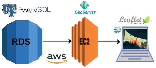
Nominal Land Value Map
Open Source Cloud GIS Framework for Real Estate Valuation
Muhammed Oguzhan Mete
,
Tahsin Yomralioglu
January 2019
PDF
Cite
Type
Conference paper
Publication
International Symposium on Applied Geoinformatics
geographic information systems
GIS
cloud GIS
real estate valuation
nominal valuation
open source
Cite
×