Avatar

Muhammed Oguzhan METE

PhD, Associate Professor

Istanbul Technical University Geomatics Engineering Department

metemu@itu.edu.tr

Biography

Dr. Muhammed Oğuzhan Mete is an Associate Professor in the Department of Geomatics Engineering at Istanbul Technical University (ITU). Having completed his BSc, MSc, and PhD in the Geomatics Engineering program at ITU, Dr. Mete conducts academic research in the areas of land management, Geographic Information Systems (GIS), artificial intelligence, machine learning, and geospatial big data. His work focuses particularly on spatial analysis and decision support systems based on the integration of GIS with artificial intelligence and data-driven approaches. His research also encompasses disaster management, climate change, real estate valuation, and spatial decision support systems, with roles in various national and international projects in these fields. The approaches he develops offer innovative solutions for the analysis and interpretation of spatial data, contributing to both the academic literature and practical applications. In line with emerging technologies, he is currently involved in projects focusing on GeoAI, digital twin-based smart city applications, and sensor technologies.

Interests

  • Land Management
  • Geographic Information Systems
  • GeoAI
  • Machine Learning / Deep Learning
  • Smart City
  • Big Data Analytics
  • Cloud Computing

Education

  • PhD in Geomatics Engineering, 2019 - 2022

    Istanbul Technical University

  • MSc in Geomatics Engineering, 2017 - 2019

    Istanbul Technical University

  • BSc in Geomatics Engineering, 2012 - 2017

    Istanbul Technical University

Recent Publications

Quickly discover relevant content by filtering publications.

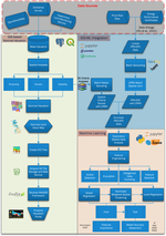
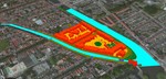
Flood Risk Analysis with Explainable Geospatial Artificial Intelligence (GeoAI) Techniques

Extreme precipitation events, rapid urbanization, and irregular land use have significantly increased flood risk in recent years. In …

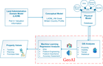
Developing GeoAI Integrated Mass Valuation Model Based on LADM Valuation Information Great Britain Country Profile

Access to information pertaining to land facilitates strategic planning for individuals, businesses, and governmental entities and …

Disaster management with cloud-based geographic information systems: site selection of landfill areas after Kahramanmaraş, Türkiye earthquake sequence

On February 6, 2023, the earthquakes centered on Kahramanmaraş-Pazarcık and Kahramanmaraş-Elbistan affected several provinces in the …

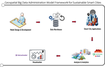
Geospatial Big Data Analytics for Sustainable Smart Cities

Growing urbanization cause environmental problems such as vast amount of carbon emissions and pollution all over the world. Smart …

Coğrafi Bilgi Sistemleri Entegreli Makine Öğrenmesine Dayalı Toplu Taşınmaz Değerleme Modelinin Geliştirilmesi

Küresel arazi idaresi sisteminin temel fonksiyonlarından biri olan arazi değeri ile planlama, vergilendirme, imar uygulamaları gibi …

Projects

*

Afet ve Acil Durum Yönetimleri için 3-Boyutlu Birlikte-Çalışabilir Coğrafi Veri Tabanının Geliştirilmesi

TÜBİTAK 1001 | 116Y203

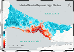
Coğrafi Bilgi Sistemi İle İstanbul İli Nominal Taşınmaz Değer Haritasının Oluşturulması

İTÜ BAP | MYL-41706

Recent Posts

Writing technical content in Academic

Academic is designed to give technical content creators a seamless experience. You can focus on the content and Academic handles the …

Contact

  • Istanbul Technical University Ayazaga Campus Civil Faculty Geomatics Engineering Department Room G304, Istanbul, 34469