Research Interests
Ağustos 16th, 2021
Mapping and modelling crustal deformation using geodetic data such as InSAR, GPS and levelling
Mapping, monitoring and modelling ground deformation due to oil, gas and water extraction
Deformation of volcanoes Tectonic Geomorphology Coulomb stress modelling Geodynamics Structural geology Earthquake Geology
Remote sensing for agriculture
-
Deformation of volcanoes Tectonic Geomorphology Coulomb stress modelling Geodynamics Structural geology Earthquake Geology
Remote sensing for agriculture
-
Coseismic deformation of the Orta-Çankırı earthquake, 2000

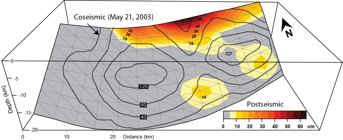
Postseismic deformation of the 2003 Zemmori (Algeria) earthquake